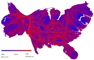
A cartogram is a map in which a thematic variable replaces land area or distance. This often distorts the area or size of the map. The variable can be anything like income, population, gross national product, etc.
http://en.wikipedia.org/wiki/File:Cartlinearlarge.png
This cartogram has the counties of the country rescaled to depict population, and it also shows the popular vote during the 2004 elections.