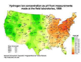
In meteorology, isopleths is the term used for any type of contour line.

This isopleth map shows the different pH concentration levels across the US. The levels are dotted and the surrounding colors correlate to the different concentration levels.
http://dwb4.unl.edu/chem/chem869v/chem869vlinks/weather.about.com/newsissues/weather/library/weekly/aa071600a.htm
No comments:
Post a Comment