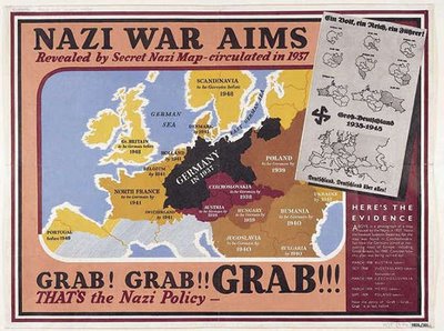
Propaganda Maps are used by people in power to show the control or exploitation of areas. Its often used politically to show national threats.
This map was used during WWII by the British to show the threat that Germany was posing as an expanding power, and showing how they planned on taking over the surrounding countries.
No comments:
Post a Comment